Editor's review
This is a software that lets you find clusters of MapPoint data points.
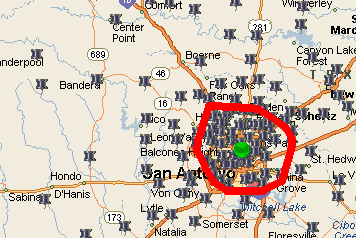
MPCluster is able to do cluster analysis on map data points, specifically on Microsoft`s MapPoint data sets available as pushpin and shaded area data sets. The program can actually work with any kind of datasets available from MapPoint but, typically cluster analysis is done on these two data types. It finds the data points that fall into natural clusters and defines area that contains data points of this cluster. Cluster results can be drawn as map annotation (centroid pushpins and/or cluster boundary shapes). The user is able to define the maximum number of clusters and the maximum and minimum size of each to be found. Primarily such analysis would be made to define an area to be covered in a sales call, or to target product sales to clusters that are likely to be most receptive.
The tool can use multiple annotation layers. Being basically a geographic information system most of these analyses involve shapes, distances between clusters, managing cluster annotations etc. The data can be exported to Excel for additional analysis, if needed. The tool works with MapPoint 2010 version too, OS environment supported includes Windows 7. If you need help with finding sales territories and product sales, finding the best shop/distribution outlets, business intelligence etc. then this would be a useful tool. Try it out with your own sales data to ensure the solution works for you during the trial period. Do remember that you will need to invest in MapPoint too, if you do not have one in the organization.
User comments